
Where are noxious weeds growing?
Mapping Noxious Weeds
Canada Thistle, Scotch Broom and Spotted Knapweed are some examples of Class B and Class C Noxious Weeds that are readily found in many parts of Washington. Other weeds, though, such as Garlic Mustard, Wild Four O'Clock, and Dyer's Woad are Class A Noxious Weeds can be hard to find since they have either limited presence here in the state or are thought to be currently eradicated, but pose a threat to re-invade.
The challenge with Class A Noxious Weeds and other limited invasive weeds is to find them when they first establish in our state. They can't be controlled if they aren't found!
If invasive species are detected early-on, when they are just a single plant or in small numbers, fewer resources will be needed for management. Early detection also provides information about where else a new invader may establish in similar nearby habitats. Mapping these locations allows for site monitoring and also provides information for examining noxious weed invasions and management at different scales. For larger scale infestations, mapping tracks the progress of management methods and guides what changes may be needed.
There are a number of mapping databases, programs and opportunities to use and get involved with in Washington.
Online sources for maps
The Washington State Department of Agriculture (WSDA) created county level distribution maps of each of Washington's noxious weed species. These maps can be found WSDA's website and also on the State Weed Board's website under each plant species. Each species' map displays the information in categories of number of infested acres. These maps were created in 2011 and are continually being updated, with the most recent maps produced in 2018. They also have the WSDA State Noxious Weed Data Viewer which displays point data of noxious weeds records collected in WA.
Herbarium records - dried, pressed plant samples - are a valuable source of information for documenting and confirming the identification of plants including noxious weeds. The University of Washington Herbarium at the Burke Museum (WTU) provides online maps of collected herbarium species in their image collection database and created a Washington weed mapping tool on their website. In addition, they are a part of the Consortium of Pacific Northwest Herbaria, along with 18 other herbaria in Washington. This online portal provides access to and maps herbarium records from all over the Pacific Northwest.
County presence/absence maps and point data are available online through EDDMapS, Early Detection and Distribution Mapping system, an online mapping and reporting system, for select invasive species in the entire United States. This is an excellent resource to check as not all invasive plant populations are documented with herbarium specimens. iNaturalist also has recorded observations of species from all over the world that can be searched for specific plants.
Can I help to map Noxious Weeds?
Yes you can!
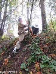
There are opportunities for anyone to take part in the hunt for these early detection invasive plants. Volunteer groups are being trained to find early invaders in parts of Washington.
![]()
The Pacific Northwest Invasive Plant Council trains volunteers to look for noxious weeds on public lands in four Cooperative Weed Management Areas in Washington, which cover parts of eastern and western Washington.
![]()
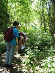
The King County Noxious Weed Control program has an Upper Snoqualmie Weed Watchers program, which trains volunteers to survey for noxious weeds in the Middle Fork Snoqualmie Valley and the Snoqualmie Pass Gateway trails of the South Fork Snoqualmie.
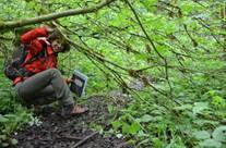

The Mountaineers have a Wilderness Weed Watchers program, offering training to volunteers who “adopt” an area to watch for weeds on trails or in lakes in the Mt. Baker-Snoqualmie National Forest.

Besides providing online maps of invasive species, EDDMapS also created free smart phone applications (apps) for use in western states including Washington that anyone can use to map and report select invasive species. When an invasive species is mapped and reported to EDDMapS using your smart phone app, an alert is sent to specific land managers to inform them of the new record. Once that information is verified, it will be available in the online maps (if it is on public land) that can be created for each species.
![]()
The Washington Invasive Species Council developed the WA Invasives smart phone app for iPhones and Android that allows you to record sightings of any invasive species in Washington, not just plants!
Please contact us with additional questions about Noxious Weed mapping and maps in Washington.
